 |
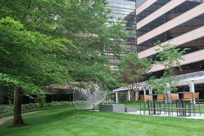
| This was the site of the Dulin farmhouse in the 1700s. |
The wooded area along the upper section of Holmes Run near Providence RECenter in Falls Church was once a part of a slave-holding plantation in the 1700s. The Camp Alger military base was there in 1898. And in the 1920s, it was the site of failed plans for a horse-racing track, golf course, and housing development.
Amateur historian Craig Day, who grew up in the area and has been exploring it ever since he was a student at
Falls Church High School in the 1970s, led a tour of the area last week hosted by the
Friends of Holmes Run. Day, a retired geographer with the Defense Department, is a track and field coach at his old school.
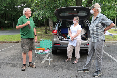 |
| Craig Day describes objects discovered in the Holmes Run watershed. |
Before leading a walk through the watershed, Day showed off some of the artifacts he found in the area, including Native American arrowheads, metal pipes from old wells, military medals, glass bottles, a flag holder and compass from Colonial times, a live Civil War shell, a brick with a dog paw print, and much more.
When Virginia was still a British colony, the Dulin family settled in the area as a tenant on land owned by John Fitzhugh. The Dulin farmhouse was built in the 1700, Day says. They had a spring house, barn, and fields of wheat and corn tended by slaves.
During the Civil War, the area was considered no-man’s land between the Union and Confederate lines, and the Dulin property was the setting of several skirmishes.
In 1887, Charles and Emma Campbell purchased the Dulin property and named it Wilderness Farm. The Campbell family owned it until 1901.
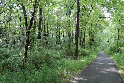 |
| The Holmes Run trail on the former site of Camp Alger. |
After the sinking of the USS Maine in Havana in February 1889 ushered in the Spanish American War, the property was rented to the Army for a military training base. There was a huge tent city, known as Camp Alger, named for Secretary of the Army Russell A. Alger.
Camp Alger housed 30,000 soldiers from all over the country. It had a field hospital and several wells, including one 150 feet deep. A community of vendors sprung up near what was later Route 50 to sell goods to the soldiers.
Five months later, Camp Alger was closed following a typhoid outbreak. While many soldiers got sick, only seven died, Day says. By the time the epidemic ended, the war was over.
The Dulin house was abandoned in the 1920s and fell to ruin. By 1937, the roof had caved in. Eventually, only the chimney was left standing.
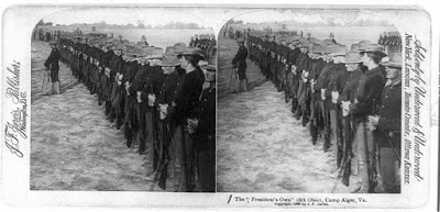 |
| The 8th Ohio Infantry Regiment at Camp Alger. |
During the 1920s, the property was owned by the Chiles family. Around that time, a residential community with single-family houses called Strathmeade was planned on the site, with a golf course, club house, and horse trails.
Although construction started on the golf course, the project was dropped after the stock market crashed in 1929.
The Chiles family owned the property until the late 1970s. There were plans for a horse-racing track in the 70s, which never materialized. Planning then started on the office park along Fairview Park Drive.
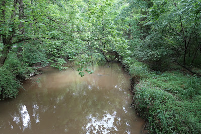 |
| Holmes Run |
An office building initially housing Computer Science Corp. was built on the site of the Dulin house in 1984. The building is currently occupied by General Dynamics.
Day wrote a history of the Chiles tract for a Fall Church High School history class. His goal is to have a permanent display of his artifacts at Falls Church HS or Thomas Jefferson Library.
Day is currently working with teachers at FCHS to create an interdisciplinary curriculum on the history and environment of the land around the school.


Thanks for this informative piece. I appreciate that we have advocates of our history that are willing to share our past. Our past is the precursor of our future for better or worse. Learning our history will hopefully keep us from making the mistakes of the yesterdays and map out a path for better tomorrows.
Amen. Great article and love the history.
Thanks for the article, Ellie. I wonder if you can see the Camp Alger site from the 1930's aerial photography available on the Fairfax County GIS web site:
https://fairfaxcountygis.maps.arcgis.com/apps/webappviewer/index.html?id=0612f9deb6bb4f0a9fa5cdce0cc75144
Craig Day would probably know the answer to that.
Does anyone know how to contact Craig Day? I am a Dulin descendant and would love to connect with him.