The (proposed) Annandale Greenway: a path from Annandale Community Park to Green Spring Gardens
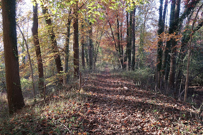 |
| The Annandale Greenway runs through the Manassas Gap Railroad Park. |
By James Albright
Stretching from the edge of the Beltway all the way to Alexandria at Shirley Highway, the Annandale area is a rich mix of residential neighborhoods, busy businesses, crowded roads, and green parks.
Rather than a sense of a single community, there is strong identification with many little communities. The overall experience of Annandale is somewhat disjointed and, in light of its proximity to so many growth areas, is a bit unanticipated. How can this change?
Remarkably, all the areas that make up Annandale are connected, albeit by happenstance rather than explicit design. There is, however, a way across Annandale, a way that once improved and clearly identified, can lead to a more integrated community.
What I call the “Annandale Greenway” is a collection of paths and sidewalks that pulls together much of Annandale. The Annandale Greenway connects all major parks in our area, passes schools, churches, coffee shops, and any number of neighborhoods and, most important, creates a streamlined way to access Annandale’s downtown from east and west. Let me show you.
The western end of the Annandale Greenway starts at the Annandale Community Park off Hummer Road.
Related story: Explore a Park – Walk through history in Annandale’s Manassas Gap Park
One fascinating advantage of establishing the Annandale Community Park as a starting point is that, without much effort, the user can also access the Cross-County Trail across the Beltway along Accotink Creek. This area also has the Packard Center and a small art gallery.
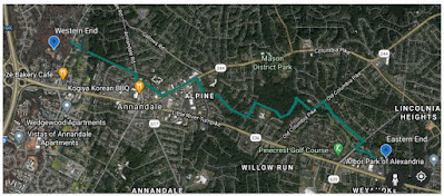 |
| The Annandale Greenway |
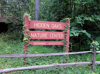
From here, the Greenway passes the Hidden Oaks Nature Center, runs along Royce Street, crosses Hummer Road, continues into the small neighborhood across the road following the sidewalk, and onto an asphalt trail off a cul-de-sac on Royce Court.
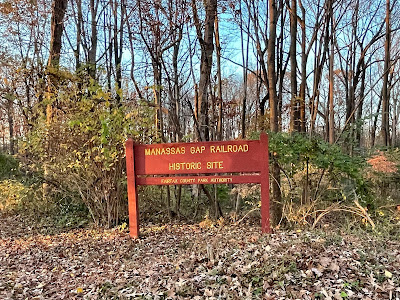
About 100 yards along, the trail enters the Manassas Gap Railroad Park, a linear park full of historic significance. The trail passes between small neighborhoods and behind apartment complexes. Connectors to these would give easy access to the parks to the west.
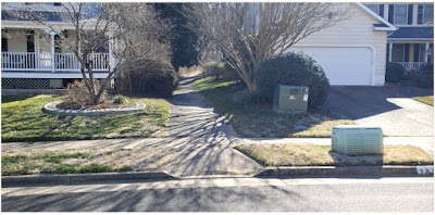 |
| The entrance to the Manassas Gap Railroad Park squeezes between two houses on Royce Court. |
The trail exits the park via a mostly informal path onto Medford Drive, maintaining the linear direction of the now-buried rail line. Medford dead-ends on Annandale Road; Greenway users turn right, then almost immediately left onto Poplar Street. This older business area of downtown Annandale is a safe passage off the main roads. At the end of Poplar, the Greenway user crosses around the ACCA building straight onto Columbia Pike.
This part of the Greenway parallels the Pike in an area that most likely will end up as the developed part of downtown Annandale. A sidewalk improvement project is in the works here, and there are restaurants, tea shops, and coffee places for a quiet respite. We have already traveled 1.5 miles to get here from the start at Annandale Community Park. While this area isn’t yet very attractive, there is no doubt that it will be someday.
The Greenway heads along Columbia Pike and turns right on Evergreen Lane. A few blocks before Evergreen dead-ends on Little River Turnpike by George Mason Regional Library, the Greenway turns left and heads up Alpine Drive, traversing a great collection of Annandale homes for a couple of blocks.
At the end of Alpine, the Greenway continues along an asphalt path between homes and along what must surely be the last unpaved road in Annandale. This is a critical connector in the whole Greenway, and the houses here are a very cool collection of homes.
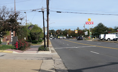 |
| Columbia Pike in central Annandale |
Once the trail reaches Roberts Avenue, the Greenway turns left for one block for the only real slope of the entire path. Here is Mason District Park – one of the highest points in Mason District – and a quick right off of Roberts takes the traveler right into the park’s rear section.
If the user continued straight ahead, they would soon arrive at the main part of Mason District Park – soccer fields, amphitheater, and weekly farmer’s market in the summer. To the right we go, passing behind Columbia Elementary School and close to the Mason District Dog Park.
The Greenway continues along the trail until it reaches a place where a trail branches off to the right – the bed of an old farm path. Turning here, we head toward Old Columbia Pike along an underused path that, nonetheless, is one of the back access points to Mason District Park.
Once on Old Columbia we turn left across a small bridge, hugging the road. This is the only area in which the Greenway user has to walk or bike close to traffic. In time, this path will need to be upgraded.
Shortly after this stretch, the user turns onto Elmdale Road and enters a large asphalt trail that runs the entire length of that road. The Pinecrest Golf Course is on the right, a beautiful neighborhood is across the street. This long stretch is very popular with locals, of course. At the end of Elmdale, a right on the trail paralleling Braddock leads to a crosswalk at the entrance to Green Spring Gardens.
Green Spring Gardens, like Annandale Community Park and Mason District Park, are community jewels that can now be connected along the Annandale Greenway. Green Spring is an amazing horticultural center with a historic home anchoring its 35 or so acres.
The Annandale Greenway edges the Gardens, exiting along Green Springs Road toward Little River Turnpike. In the future, a trail extension along Turkeycock Run will take the Greenway further down toward Lincolnia and the edge of Fairfax County.
Today, the Annandale Greenway is just a collection of relatively linear paths and connected ways through the heart of the community. Many communities throughout the nation have established community trails like the proposed Annandale Greenway – you probably know of a few. In our community, we have the chance to establish a linear path that pulls together the many disparate parts of the area in which we live.
A well-conceived Greenway can serve not only to unite what currently exists, but can itself be a stimulus for further growth and integration. If properly marked and signed, it can provide a key transportation ingredient for much of Annandale. Businesses can (and will, as seen elsewhere) take advantage of the opportunities it provides.
Even though the Greenway as proposed is linear, it can serve to help focus community activities. Finally, by garnering attention, it can help our community create a unique feature, one that builds on our unique character and geography, providing a key recreational feature right here in our backyards.
Related story: Community input sought on ActiveFairfax Transportation Plan
It is my intent to begin a discussion about creating this Greenway, first by publicizing its concept and then working to include it (or a reasonable facsimile) into the upcoming ActiveFairfax plan.
As the outline of the Greenway already exists, capital improvements are fairly low cost and can be developed over time. These would include improved/widened paths, appropriate spot changes to make movement along the Greenway safe and, perhaps easiest to get started with, a signage or wayfinding plan. Over time, as these pieces come to fruition, the Greenway can take its positive shape.
This piece was originally published in James Albright’s blog “Living Life in 4D.”


As an avid walker, this sounds great to me!
Here here! Fully support this initiative, count your neighbors at Bike Burke in!
Fantastic idea, vision!
I am reminded of the Atlanta Beltline, a much-larger scale project, that uses trails to create vibrant city life, environmental restoration, economic growth, and more.
I'd like to see a fresh look at 3-acre Poe Terrace Park (adjacent to the George Mason Library on Little River Turnpike), which would require a short roundtrip on a spur off of your Greenway. Maybe for version 2.0. The park is today choked by vines, bamboo, trash, but could be another jewel with a purposeful revitalization effort.
Keep us posted.
Nice article James
I am ready to pitch in. How great it would be to have it all connected.
This would be a fabulous big asset for Annandale.
This is a wonderful idea! I am willing to volunteer to help make this happen.
Wonderful idea! How can we move this forward? What does the county council think?
I have walked all of these pieces over the past few years with my (big) dogs. A nice idea, but there are some secluded places along the route. I'd just say to be careful, don't go out alone, and be aware of your surroundings at all times.
The ActiveFairfax Plan maps close on May 1. Get your neighbors to "like" the routes on the interactive map.
Wonderful idea!