Residents urged to comment on potential Route 50 improvements
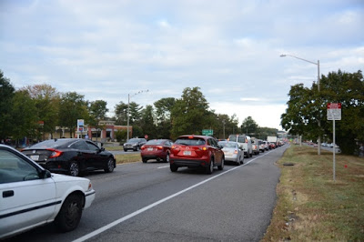 |
| Eastbound Route 50 approaching Allen Street. [VDOT] |
The Virginia Department of Transportation is considering a long list of alternatives to improve traffic and pedestrian safety along Route 50 (Arlington Boulevard) between Jaguar Trail and Wilson Boulevard in the Falls Church area.
This study is being conducted through VDOT’s Strategically Targeted Affordable Roadway Solutions (STARS) program. The Route 50 STARS Study looks at traffic and safety conditions along the corridor, considers alternative improvements, makes recommendations, and develops cost estimates.
Residents are invited to view a video presentation on the project and submit feedback to VDOT. An online survey will be available on Oct. 30. Comments can also be submitted to [email protected].
The final study is expected to be completed and posted online this winter.
The study doesn’t include a pathway for funding and implementation. The purpose of the study is to develop proposed improvements that localities can pursue for funding and to consider including in their comprehensive plans.
According to VDOT, Route 50 averages just over 50,000 vehicles a day within the study limits.
Between January 2013 and January 2019, the annual crash rates in the study area were 32 percent to 43 percent higher than average crash rates for primary highways in Northern Virginia.
There were five crashes during that period with fatal injuries and nine with severe injuries.
The most dangerous Route 50 intersections were at Graham Road (104 crashes), Annandale Road (98 crashes), and Allen Street (88 crashes). There were fatal pedestrian crashes in 2018 and in 2015.
The following potential improvements are identified in the study:
Jaguar Trail:
- Provide a high-visibility pedestrian crossing.
- Move the stop line northbound approach closer to the pedestrian crossing.
Crossing near Thomas Jefferson Library west of Fenwick Road:
- Move the existing pedestrian crossing to the west.
- Move bus stops to the far sides of the pedestrian crossing.
- Provide a pedestrian refuge in the median with a pedestrian railing system.
- Provide sidewalks to relocated bus stops and a new crosswalk.
- Provide high-visibility pedestrian crossings across the frontage roads.
- Reduce the length of the eastbound left-turn lane and expand the median.
- Provide pedestrian warning signs.
Allen Street:
- Change lane use on the northbound Allen Street approach.
- Provide a high-visibility pedestrian crossing.
- Straighten the crosswalk across the east approach.
- Extend the median and provide a pedestrian refuge.
Graham Road:
- Create a pedestrian refuge in the median.
- Provide improved pedestrian connections in the northeast and southwest corners.
- Change lane uses on the eastbound approach.
- Extend the median on the westbound approach.
- Move the pedestrian crossing across the westbound approach to the east.
- Extend the raised median island on the southbound approach.
Woodlawn Avenue:
- Move the bus stop to the far side of the intersection.
- Provide a sidewalk connection to the relocated bus stop.
- Provide a high-visibility pedestrian crossing across Woodlawn Avenue.
- Provide pedestrian warning signs in the roadway.
Marshall Street to E. Tripps Run Road:
- Provide a mid-block pedestrian signal with fencing to direct people to the pedestrian crossing between Summerfield Road and E. Tripps Run Road.
- Move the pedestrian crossing to the west at Marshall Street.
- Provide a pedestrian refuge in the median at Marshall Street.
- Move bus stops and construct sidewalks at Summerfield Road and Marshall Street.
- Remove bus stops at Greenway Boulevard.
- Add pedestrian warning signs in the roadway.
- Construct new ramps in the southwest and northwest corners of the Marshall Street intersection.
Annandale Road:
- Add high-visibility pedestrian crossings.
- Extend the median and create a refuge for pedestrians crossing the westbound approach.
- Construct a right-turn lane on the northbound approach and require northbound right-turning vehicles to use the eastbound frontage road.
- Reconstruct the island in the southeast corner to promote northbound right turns onto the frontage road from a new right-turn lane.
- Provide an acceleration lane for northbound right turns from the frontage road onto eastbound Route 50.
South Street/Beechwood Lane:
- Provide a pedestrian crossing on the south side of South Street.
- Lengthen the westbound left-turn lane to South Street on the south side.
- Construct directional islands to prohibit westbound U-turns and left turns from southbound South Street at the eastern median opening.
- Modify South Street on the south side of Route 50.
Aspen Lane – minor changes, option A:
- Improve the sight distance to pedestrians by trimming shrubs and tree branches.
- Provide a pull-off area for buses at the bus stop.
- Add an eastbound right-turn taper to the off-ramp.
- Enhance safety for U-turns from westbound Route 50 to the eastbound frontage road.
- Provide warning signs on the eastbound approach.
- Relocate the guide sign.
- Provide dashed pavement markings for westbound U-turns.
Aspen Lane – extended exit lane, option B:
- Improve sight distance to pedestrians by trimming shrubs and tree branches.
- Relocate the bus stop.
- Add an eastbound right-turn lane to the off-ramp.
- Enhance safety for U-turns from westbound Route 50 to the eastbound frontage road.
- Add warning signs on the eastbound approach.
- Relocate the guide sign.
Planning for the roadway improvements is estimated at $5 million to $12 million. The cost estimate for planning the pedestrian and bus stop changes ranges from $2.5 million to $5 million.
It's very hard to visualize, but it sounds like there will be more crosswalks than space for cars. Yes, crosswalks do need to be there and very prominent, but how many is the question. Concern that the traffic flow will be hampered remarkably with this plan.