Explore a Park: Walk through history in Annandale’s Manassas Gap Park
 |
| This trail follows an old railroad bed. |
This is the first in a series on parks in the Annandale/Mason District area.
Manassas Gap Park and Historic Site is a 13.3-acre park between Hummer Road, Little River Turnpike, and Annandale Road.
Features – A straight trail runs along the southern edge of the park from Royce Court to Medford Drive. During the fall and winter, one can see houses on Woodland Road and the Fairmont Gardens apartments. There’s a side trail leading to Coon Branch, a tributary of Accotink Creek.

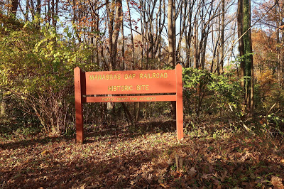
Access – There’s a sign announcing the park at the dead end on Woodland Road. The park can also be accessed from an asphalt walkway between 7534 and 7536 Royce Court or from the wooded area on Medford Drive by the Parliaments.
History – The trail runs along the roadbed for the never-completed Independent Line of the Manassas Gap Railroad. The remnant of the rail line consists of 1,870 feet of railroad bed, including high fill areas, shallow cuts, and two historic culverts constructed from large hand-hewn stones. As a result, the park is listed on the Virginia Landmarks Register.
The Manassas Gap Railroad was incorporated in 1850 by Alexandria merchants with the goal of linking the upper Shenandoah Valley to Alexandria.

The 35-mile Independent Line of the Manassas Gap Railroad was conceived of later as a means of expanding the Northern Virginia market and increasing the profitability of the original line.
The park is located on property that was originally granted to Thomas, Lord Culpeper, in 1649 as a reward for his support of King Charles II. Ownership subsequently passed to Thomas, the Fifth Lord Fairfax, William Fitzhugh, then to Henry Fitzhugh of Stafford County. At that point, the 12,000-acre property was known as the Ravensworth tract. The land was later divided among Fitzhugh’s heirs, and ownership turned over several times.
By the time the Manassas Gap Railroad Co. began acquiring land for the Independent Line, the property where the park is now located was owned by James Purdy, who farmed the land using slave labor. The company sued 58 landowners who refused to be bought out, including Purdy. Those cases were eventually settled.
Construction of earthworks started in 1854, but steel rails were never laid. Work was suspended in 1857 due to mounting debt and growing hostilities preceding the Civil War, and the project was abandoned.
During the Civil War, the Independent Line roadbed was used by both sides to move troops. In one instance, Union Brigadier General Louis Blenker and his 45th New York Infantry established a picket line along the Independent Line near Annandale in fall 1861.
Two hundred Confederate cavalrymen attacked those pickets on Dec. 2, 1861, killing one Union soldier and capturing 14 others.
The Manassas Gap Railroad never recovered from the Civil War. In 1867, it merged with the Orange and Alexandria Railroad to become the Orange, Alexandria and Manassas Railroad. Eventually, the whole network was absorbed into the present-day Southern Railway System.
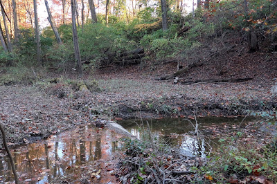 |
| The former railroad bed, and now the trail, is on top of the ridge. |
Purdy had been one of only four men in the Annandale precinct to vote against secession. In 1861, he returned to his native New York. He sold the property to Christian Seaman, a farmer, in 1871.
The land changed hands several times until Fairfax County acquired six separate parcels between 1975 and 1981 and subsequently designated the area as the Manassas Gap Railroad Historic Site.
The historical information is from the Fairfax County Park Authority, The Story of Ravensworth, the Fare Facs Gazette, and the Virginia Landmarks Register.
Very interesting. Thank you.
Thank you for the great information as always. We're going to go check it out today!
Was one of the embankments off Woodburn Road above Accotink Creek?